
Understanding Dothan’s Geographic Location and Climate Zone
Where is Dothan Located?
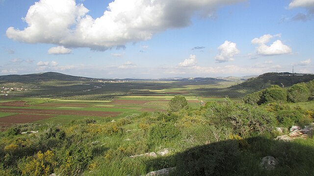
Dothan sits in the heart of Alabama’s Wiregrass region, strategically positioned in the southeastern corner of the state. This city, often called the “Peanut Capital of the World,” experiences a unique blend of weather patterns thanks to its location roughly 100 miles from the Gulf of Mexico. The proximity to the Gulf plays a crucial role in shaping Dothan’s weather patterns, bringing moisture-laden air masses that influence everything from daily temperatures to seasonal precipitation.
The city’s elevation of approximately 320 feet above sea level contributes to its moderate topographical influence on local weather. Unlike mountainous regions that create dramatic weather variations, Dothan’s relatively flat terrain allows weather systems to move through with fewer obstacles, creating more predictable patterns while still maintaining the dynamic nature of southeastern weather.
Climate Classification of Dothan
Dothan falls under the humid subtropical climate classification, characterized by hot, humid summers and mild winters. This climate zone extends across much of the southeastern United States, but Dothan’s specific location gives it distinctive characteristics. The Köppen climate classification designates it as “Cfa,” indicating a temperate climate with hot summers and no dry season.
This classification means you can expect year-round precipitation, though it varies seasonally. The subtropical nature ensures that freezing temperatures are relatively rare, making Dothan an attractive destination for those seeking to escape harsh northern winters. However, the humidity factor means that summer temperatures often feel more intense than the thermometer suggests.
Dothan Weather Throughout the Year

Spring Weather in Dothan (March-May)
Spring in Dothan brings a delightful awakening from the mild winter months. This season represents one of the most pleasant times to experience the city’s weather, with comfortable temperatures and moderate rainfall supporting the region’s lush vegetation.
Temperature Ranges in Spring
March typically sees daytime highs climbing from the upper 60s to mid-70s Fahrenheit, while nighttime lows hover in the 40s and 50s. By April, you’ll notice a significant warming trend with highs reaching the upper 70s to low 80s, and nighttime temperatures settling into the comfortable 50s and 60s. May ushers in the approach of summer with highs often reaching the mid-80s and lows in the 60s.
The temperature progression during spring feels gradual rather than dramatic, allowing residents and visitors to slowly shed their winter layers. This gradual warming creates ideal conditions for outdoor activities, from gardening to hiking in the nearby state parks.
Rainfall Patterns During Spring
Spring rainfall in Dothan averages around 3-4 inches per month, with April typically being one of the wetter months. The rain often comes in the form of afternoon and evening thunderstorms, which can be quite spectacular to watch but rarely last for extended periods. These storms serve an important purpose, replenishing groundwater and supporting the agricultural activities that define the region.
The timing of spring rains usually allows for pleasant mornings and early afternoons, with storm activity developing later in the day. This pattern makes spring an excellent time for morning outdoor activities and evening relaxation once the storms pass.
Summer Weather in Dothan (June-August)
Summer arrives in Dothan with characteristic southern intensity, bringing hot temperatures, high humidity, and frequent afternoon thunderstorms. While some might find the summer heat challenging, others embrace the warm weather and the vibrant outdoor culture it supports.
Heat and Humidity Levels
June through August sees daytime highs consistently reaching the upper 80s to low 90s Fahrenheit. However, the heat index often makes it feel like temperatures are in the upper 90s or even low 100s due to the significant humidity levels. Morning lows during summer typically settle in the low to mid-70s, providing only modest relief from the daytime heat.
The humidity in Dothan during summer often exceeds 70%, creating that characteristic “sticky” feeling associated with southern summers. This moisture in the air comes primarily from the Gulf of Mexico, carried inland by prevailing winds. While the humidity can feel oppressive, it also contributes to the lush, green landscape that defines the region.
Summer Storm Activity
Summer storms in Dothan are both a blessing and a spectacle. These afternoon and early evening thunderstorms provide crucial cooling and help break up the heat of the day. Typically developing between 2 PM and 6 PM, these storms can produce heavy rainfall, frequent lightning, and occasionally small hail.
The storms usually move through relatively quickly, lasting 30 minutes to an hour, followed by cooler, fresher air. This daily cycle of heat building to storms creates a rhythm that locals learn to work around, often planning outdoor activities for morning hours and indoor pursuits during the afternoon storm period.
Fall Weather in Dothan (September-November)
Fall represents many people’s favorite season in Dothan, offering relief from summer’s intensity while maintaining warm, pleasant days perfect for outdoor activities. The season brings beautiful foliage changes and some of the year’s most comfortable weather.
Temperature Transitions
September still feels quite summer-like, with highs in the upper 80s and lows in the upper 60s to low 70s. However, you’ll notice the humidity beginning to decrease, making the heat more bearable. October brings the most dramatic changes, with highs dropping to the comfortable 70s and 80s, while nighttime lows settle into the 50s and 60s.
November ushers in the approach of winter, with daytime highs typically in the 60s and 70s and nighttime lows dipping into the 40s and 50s. This temperature progression allows for extended outdoor seasons, with many activities remaining comfortable well into November.
Autumn Precipitation
Fall precipitation in Dothan tends to be lower than spring and summer levels, averaging 2-3 inches per month. The rainfall pattern shifts from the intense afternoon thunderstorms of summer to more gentle, widespread rain events. This change in precipitation pattern, combined with lower humidity, creates some of the year’s most pleasant weather conditions.
The reduced rainfall and lower humidity make fall an ideal time for outdoor events, festivals, and agricultural activities. Many of Dothan’s major outdoor events are scheduled during this season to take advantage of the favorable weather conditions.
Winter Weather in Dothan (December-February)
Winter in Dothan differs dramatically from what residents of northern states experience. Rather than harsh cold and snow, Dothan’s winters are characterized by mild temperatures and occasional cool snaps that rarely last more than a few days.
Mild Winter Temperatures
December through February sees daytime highs typically ranging from the upper 50s to mid-60s Fahrenheit. Nighttime lows usually settle in the 30s and 40s, with freezing temperatures occurring only occasionally. The mildest winter days can see temperatures reaching the 70s, while the coldest might drop into the 20s, though such extremes are rare.
This mild winter climate means that many plants remain green year-round, and outdoor activities can continue with proper clothing. The lack of snow and ice makes winter travel much easier compared to northern regions, though occasional frost can create slippery conditions on bridges and overpasses.
Winter Weather Events
While severe winter weather is uncommon in Dothan, it’s not unheard of. Ice storms can occur every few years, creating hazardous driving conditions and sometimes causing power outages. Snow is extremely rare, with measurable snowfall occurring perhaps once every five to ten years, and significant snow accumulation being even rarer.
When winter weather events do occur, they often shut down the city since residents and infrastructure aren’t equipped for icy conditions. However, these events typically last only a day or two before temperatures rise above freezing and conditions return to normal.
Monthly Weather Breakdown for Dothan

January Through March Weather Patterns
January typically represents the coldest month in Dothan, with average highs around 60°F and lows near 38°F. Rainfall averages about 3.5 inches, often coming as gentle, soaking rains rather than intense storms. February sees a slight warming trend with highs climbing to the mid-60s and lows rising to the low 40s.
March marks the beginning of spring’s return, with noticeable increases in both temperature and daylight hours. Average highs reach the low 70s, while lows settle in the upper 40s. Rainfall during March often increases as storm systems become more active with the changing seasons.
April Through June Weather Trends
April brings some of Dothan’s most pleasant weather, with comfortable temperatures and moderate rainfall supporting the spring bloom. Average highs reach the upper 70s, while lows settle in the comfortable 50s. This month often sees increased storm activity as cold fronts interact with warming air masses.
May continues the warming trend with highs climbing to the low 80s and lows in the 60s. Humidity begins to increase noticeably during May, hinting at the summer weather to come. June represents the transition to full summer conditions, with highs reaching the upper 80s and increasing afternoon storm activity.
July Through September Climate Data
July and August represent Dothan’s hottest months, with average highs in the low 90s and lows in the mid-70s. Heat index values often exceed 100°F due to high humidity levels. Afternoon thunderstorms become a daily occurrence, providing brief but intense rainfall and temporary cooling.
September begins the gradual transition toward fall, though temperatures remain quite warm with highs in the upper 80s. However, humidity levels begin to decrease slightly, and the frequency of afternoon storms starts to diminish as high-pressure systems become more prevalent.
October Through December Weather Overview
October offers some of Dothan’s most delightful weather, with average highs in the upper 70s and lows in the 50s. Humidity levels drop significantly, making outdoor activities extremely pleasant. Rainfall decreases to around 2 inches for the month, with most precipitation coming from passing frontal systems.
November continues the cooling trend with highs in the upper 60s to low 70s and lows in the 40s. December ushers in winter conditions with highs typically in the 60s and lows in the upper 30s to low 40s. Rainfall remains moderate, and the first frost usually occurs sometime during December.
Severe Weather and Natural Disasters in Dothan
Tornado Activity and Safety
Dothan lies within what meteorologists call “Dixie Alley,” an extension of the traditional Tornado Alley that extends into the southeastern United States. While tornado activity is less frequent than in states like Oklahoma or Kansas, Dothan does experience tornado threats, particularly during spring months when atmospheric conditions favor severe weather development.
The peak tornado season runs from March through May, with April typically seeing the highest activity. Tornadoes in the Dothan area often develop as part of squall lines or supercell thunderstorms that move through the region. The National Weather Service office in Tallahassee provides tornado warnings and watches for the Dothan area, utilizing Doppler radar and storm spotters to track dangerous weather.
Residents should have a severe weather plan that includes knowing where to take shelter, having multiple ways to receive weather warnings, and keeping emergency supplies readily available. The city’s emergency management agency regularly conducts severe weather preparedness campaigns to help residents stay safe during tornado season.
Hurricane and Tropical Storm Impacts
While Dothan sits about 100 miles inland from the Gulf of Mexico, the city can still experience significant impacts from hurricanes and tropical storms. These systems often weaken considerably by the time they reach Dothan, but they can still bring heavy rainfall, damaging winds, and flooding.
The greatest threat from tropical systems typically comes in the form of flooding from heavy rainfall rather than wind damage. Dothan’s relatively flat terrain can lead to rapid water accumulation during intense rainfall events, creating dangerous conditions on roadways and in low-lying areas.
Historical storms like Hurricane Michael in 2018 demonstrated how inland areas can still experience significant damage from tropical systems. Residents should monitor tropical weather activity during the June through November hurricane season and be prepared for potential evacuation or sheltering in place depending on the storm’s projected path and intensity.
Severe Thunderstorms and Flooding
Severe thunderstorms represent the most common weather hazard in Dothan, occurring primarily during the spring and summer months. These storms can produce damaging winds exceeding 58 mph, large hail, frequent lightning, and heavy rainfall that can lead to flash flooding.
The combination of Dothan’s geographic location and atmospheric patterns creates favorable conditions for severe thunderstorm development. The city’s drainage systems are generally adequate for normal rainfall, but intense storms can overwhelm these systems, leading to street flooding and occasional property damage.
Flash flooding can occur rapidly during severe thunderstorms, particularly in low-lying areas and near creeks and streams. The National Weather Service issues flash flood warnings when conditions favor rapid water rise, and residents should never attempt to drive through flooded roadways.
Best Weather Resources for Dothan Forecasts
Local Weather Services
The National Weather Service office in Tallahassee, Florida, provides official weather forecasts and warnings for the Dothan area. This office issues all severe weather warnings, watches, and advisories, making it the authoritative source for weather safety information. Their forecasts are available online, through NOAA Weather Radio, and via various smartphone apps.
Local television stations provide detailed weather coverage, with meteorologists who understand the specific patterns and challenges of Wiregrass region weather. Stations like WTVY News 4 and WDHN News 18 offer regular forecasts, severe weather coverage, and specialized agricultural weather information important to the region’s farming community.
The Alabama Emergency Management Agency also provides weather-related information and coordinates with local emergency management offices to ensure residents receive timely and accurate weather warnings. Their mobile app and website offer additional resources for weather preparedness and safety.
Mobile Apps and Online Resources
Modern technology has made weather information more accessible than ever before. The National Weather Service’s Weather.gov website provides detailed forecasts, radar imagery, and severe weather warnings specifically for Dothan. The site includes hourly forecasts, extended outlooks, and specialized products like agricultural weather information.
Popular weather apps like Weather Underground, AccuWeather, and the Weather Channel app all provide location-specific forecasts for Dothan. These apps often include radar imagery, severe weather alerts, and the ability to track approaching storms in real-time.
For those interested in more detailed meteorological information, resources like the Storm Prediction Center provide severe weather outlooks and analysis that can help residents understand broader weather patterns affecting the region. Social media platforms also serve as valuable resources, with local meteorologists and weather services providing real-time updates during severe weather events.
Planning Activities Around Dothan Weather
Best Times for Outdoor Activities
Understanding Dothan’s weather patterns can help you plan outdoor activities for optimal conditions. Spring and fall represent the ideal seasons for most outdoor pursuits, offering comfortable temperatures, lower humidity, and reduced risk of severe weather. March through May and October through November typically provide the most pleasant conditions for hiking, camping, festivals, and sporting events.
Summer activities require more careful planning due to high heat and humidity. Early morning and late evening hours offer the most comfortable conditions for outdoor exercise and recreation. Many locals adjust their schedules during summer months, taking advantage of cooler morning temperatures for activities like jogging, gardening, and yard work.
Winter’s mild temperatures make it possible to enjoy outdoor activities year-round, though occasional cold snaps may require warmer clothing. The lack of snow and ice means that activities like golf, hiking, and outdoor dining can continue throughout the winter months with appropriate preparation.
Weather Considerations for Events
Event planning in Dothan requires understanding the city’s weather patterns and having contingency plans for various conditions. Outdoor events are most successful during spring and fall when temperatures are comfortable and rainfall is typically moderate. Summer events need to account for high heat and the likelihood of afternoon thunderstorms.
Many successful outdoor events in Dothan are scheduled for morning hours during summer months, ending before the typical afternoon storm development. Providing adequate shade, hydration stations, and indoor backup locations can help ensure event success regardless of weather conditions.
Winter events can take advantage of the mild temperatures, but organizers should be prepared for occasional cold snaps and have heating options available. The unpredictability of winter weather in the South means that conditions can change rapidly, requiring flexible planning approaches.
Climate Change Impact on Dothan Weather
Climate scientists are studying how changing global patterns might affect local weather in places like Dothan. While the humid subtropical climate is expected to persist, some models suggest potential changes in precipitation patterns, temperature extremes, and severe weather frequency.
Preliminary research indicates that the Southeast may experience more intense heat events and potentially altered rainfall patterns. However, the specific impacts on Dothan will depend on numerous factors, including global climate patterns, regional geographic influences, and local environmental changes.
Residents and planners are beginning to consider long-term climate adaptation strategies, including infrastructure improvements to handle potential changes in precipitation patterns and urban planning approaches that account for potential temperature increases. These efforts represent a proactive approach to preparing for whatever changes the future climate might bring.
Conclusion
Dothan’s weather offers a fascinating blend of subtropical characteristics that make it an attractive place to live and visit year-round. From the comfortable springs that awaken the landscape to the intense but brief summer storms that cool the air, each season brings its own character and charm to this Alabama city.
Understanding these weather patterns empowers residents and visitors to make the most of what Dothan has to offer. Whether you’re planning a move to the area, organizing an outdoor event, or simply wanting to better understand your local climate, this comprehensive guide provides the foundation you need to work with, rather than against, Dothan’s weather patterns.
The key to enjoying Dothan’s climate lies in embracing its subtropical nature while respecting the power of severe weather when it occurs. With proper preparation, weather awareness, and an appreciation for the region’s natural rhythms, you can fully experience all that Dothan’s weather has to offer throughout the year.
Frequently Asked Questions
1. What is the hottest month in Dothan, Alabama?
July and August are typically the hottest months in Dothan, with average high temperatures reaching the low 90s Fahrenheit. However, due to high humidity levels, the heat index often makes it feel like temperatures are in the upper 90s or even low 100s during these peak summer months.
2. Does it snow in Dothan, Alabama?
Snow in Dothan is extremely rare, occurring perhaps once every five to ten years with measurable accumulation being even less frequent. When snow does fall, it’s usually light and melts quickly due to the relatively warm ground temperatures and southern latitude.
3. What is tornado season in Dothan?
Tornado season in Dothan typically runs from March through May, with April generally being the most active month. While Dothan is part of “Dixie Alley” and can experience tornadoes, they are less frequent than in traditional Tornado Alley states.
4. How much rain does Dothan get annually?
Dothan receives approximately 50-55 inches of rainfall annually, which is fairly well distributed throughout the year. Summer months tend to see more intense but brief afternoon thunderstorms, while winter and spring often bring gentler, longer-lasting rain events.
5. When is the best time to visit Dothan weather-wise?
The best times to visit Dothan are during spring (March-May) and fall (October-November) when temperatures are comfortable, humidity is lower, and rainfall is moderate. These seasons offer ideal conditions for outdoor activities and sightseeing without the intense heat and humidity of summer.