
Have you ever felt like you have explored every corner of the American map, only to discover there is a massive secret hiding in plain sight? If you haven’t yet pointed your compass toward the Ouachita Mountains, you are absolutely missing out on one of the South’s best-kept secrets. Tucked away in western Arkansas and southeastern Oklahoma, this range is the rebel of the family. Unlike the Rockies or the Appalachians that run north to south, the Ouachitas (pronounced WASH-i-taws) stretch east to west, as if they decided to go their own way .
But these mountains aren’t just geographically quirky. They are ancient, rugged, and packed with enough adventure to fill a lifetime. From digging your own diamonds in the rough to paddling rapids that might just live up to their “skull crusher” nickname, this place has it all. So, lace up your boots, and let’s take a deep dive into the mountains that time—and most tourists—forgot.
What Does “Ouachita” Mean? A Name Steeped in History
The “Good Hunting Grounds”
Before we hit the trails, we have to talk about the name. “Ouachita” rolls off the tongue with a certain rhythm, doesn’t it? It comes from the French spelling of the Caddo word washita, which translates to “good hunting grounds” . And honestly, that might be the understatement of the millennium. For centuries, this region was a buffet of natural resources, providing deer, bear, and lush landscapes for the people who lived here.
The People of the Mountains
This wasn’t just a hunting spot; it was home. The Ouachita and Caddo tribes thrived in these valleys long before European settlers arrived . Later, the mountains became a new home for the Choctaw Nation during the turbulent years of the 19th century . Walking through these woods today, you are stepping on ground that has supported human life and culture for thousands of years. It gives the rustling leaves a little more weight, doesn’t it?
How the Ouachitas Formed: A Geologist’s Masterpiece
The Ouachita Orogeny: A Continental Collision
Let’s rewind the clock about 300 million years—way before the dinosaurs started stomping around. Back then, the southern edge of North America wasn’t lounging in the Gulf of Mexico; it was smashing into South America . This massive tectonic pile-up, known as the Ouachita orogeny, pushed the ancient ocean floor up into towering peaks .
Why Do the Ridges Run East to West?
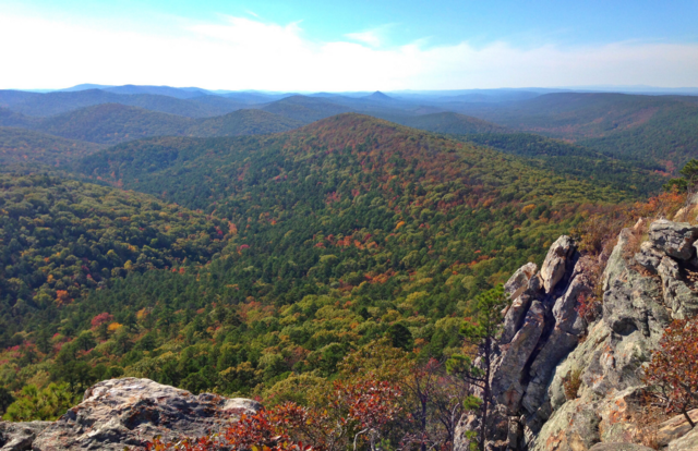
Here is the cool part. That continental crash created a series of tight folds in the Earth’s crust. Think of the land like a rug being pushed from the south. Instead of crumpling into random piles, it folded into neat, parallel ridges running east to west . This is why, when you look at a map or drive the Talimena Byway, you see those waves of green rolling out to the horizon in a direction that feels “wrong” compared to other mountain ranges.
From 10,000 Feet to Rolling Peaks
Now, don’t let the current heights fool you. At their peak (pun intended), these bad boys were likely as high as the modern Rockies, possibly topping 10,000 feet . But time is the ultimate eroder. Over eons, wind and water wore them down to the gentle giants we see today, with the highest point, Mount Magazine, standing at a respectable 2,753 feet .
Ouachita National Forest: The Backbone of the Range
A Forest with No Entrance Fee
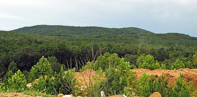
Spanning a whopping 1.8 million acres, the Ouachita National Forest is the largest national forest in the South . Established by Teddy Roosevelt in 1907, it is a playground of epic proportions. And here is a kicker: there is no entrance fee . You can drive in, find a dispersed campsite in the backcountry, and claim your own slice of wilderness without reaching for your wallet.
Wildlife Encounters: From Black Bears to Rare Salamanders
The Comeback Story of the Black Bear
The forest is teeming with life. White-tailed deer, wild turkeys, and foxes are common sights. But the real success story is the black bear. By the mid-1900s, bears were almost wiped out in the area. Wildlife officials stepped in, releasing over 250 bears from Minnesota and Canada starting in the late 1950s . Today, the population is thriving. Seeing one (from a safe distance, of course) is a reminder that nature heals when we give it a chance.
Endemic Species You Can’t Find Elsewhere
The Ouachitas are also a biological treasure chest. Because of their unique isolation and geography, they are home to creatures found nowhere else on Earth. Keep your eyes peeled for the Rich Mountain salamander or the Ouachita Mountain shiner . And if you are a tree huger, look for the maple-leaf oak, one of the rarest trees in the world, growing at only four known sites .
Hit the Trails: Hiking for Every Skill Level
The Ouachita National Recreation Trail (OT)
Stretching 223 miles from Talimena State Park in Oklahoma to Pinnacle Mountain near Little Rock, the OT is a beast . Whether you are a thru-hiker looking for a two-week challenge or a day-hiker looking for a 5-mile out-and-back, this trail offers stunning ridgeline views that go on forever.
Eagle Rock Loop: The Toughest Test
If you are looking to really test your mettle, find the Eagle Rock Loop. This 27-mile loop is considered one of the toughest in the region . It tackles nine mountains and features multiple crossings of the Little Missouri River. You will be soaked, sore, and utterly euphoric when you finish.
Lake Ouachita Vista Trail
For those who prefer their sweat with a side of water views, the Lake Ouachita Vista Trail (LOViT) offers miles of single-track winding along the shores of the clearest lake in Arkansas .
The Diamond Lakes: Crystal Clear Waters
Lake Ouachita: The Caribbean of the Mountains
Speaking of clear water, let’s talk about Lake Ouachita. Covering 40,000 acres with nearly 1,000 miles of undeveloped shoreline, this lake is a stunner . The water is so clean that it has earned the nickname “The Caribbean of the Midwest” . On a calm day, you can see down 30 feet or more.
Scuba Diving in an Underwater Forest
Here is something wild: beneath those pristine waters lies a submerged forest. When the lake was created by the Blakely Mountain Dam in the 1950s, the trees were left standing . Now, they create one of the most unique scuba diving destinations in the country. You can literally swim through an ancient forest.
The Talimena Scenic Byway: A Drive Through the Clouds
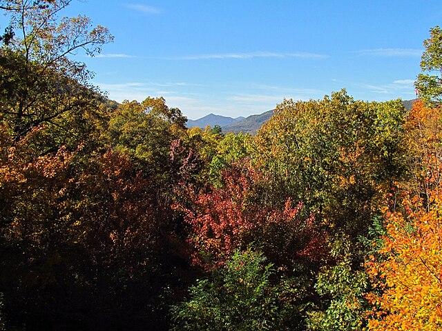
If your knees aren’t up for hiking the peaks, you can drive them. The Talimena National Scenic Byway stretches 54 miles between Mena, Arkansas, and Talihina, Oklahoma . It winds along the crests of Rich Mountain and Winding Stair Mountain. In the fall, when the oaks and hickories explode into color, this drive is pure magic. There are numerous pull-offs where you can gaze out for 60 miles, watching the ridges fade into the blue haze .
Digging for Treasure: The Quartz Crystal Capital
Ever wanted to be a prospector? Head to Mount Ida, the self-proclaimed Quartz Crystal Capital of the World . The Ouachitas sit atop one of the richest deposits of quartz crystals on the planet . You can visit “dig your own” mines, rent a shovel, and spend the day digging for your own souvenirs. These crystals formed millions of years ago when superheated water carrying silica filled cracks in the rock . Pulling a sparkling, clear point out of the red dirt is an adrenaline rush like no other.
Thrills and Chills: Whitewater and Hot Springs
The “Skull Crusher” Rapids of the Cossatot
The Ouachitas aren’t just serene; they are fierce. The Cossatot River translates to “skull crusher” in Spanish . At Cossatot Falls, the river drops 33 feet in a third of a mile, creating Class IV and V rapids that attract kayakers from all over the country. If you catch it during high water, you are in for a wild ride.
Hot Springs National Park: Where the Water is 4,000 Years Old
On the flip side of the adrenaline coin is relaxation. Hot Springs National Park sits smack dab in the Zig Zag Mountains of the Ouachita range . Here, 47 thermal springs pump out water at a balmy 143°F . Here is the mind-bender: that water fell as rain roughly 4,000 years ago, filtered down a mile into the earth, heated up, and is now bubbling up at your feet . You can fill up a jug at the public fountains and taste water that was seeping into the ground when the pyramids were being built.
Bathhouse Row: A Gilded Age Relic
And don’t miss Bathhouse Row in downtown Hot Springs. These eight magnificent bathhouses, built between 1911 and 1923, are a National Historic Landmark . You can tour the Fordyce or actually soak in the Buckstaff, experiencing the thermal waters just like gangsters and baseball legends did a century ago.
The Fourche Mountain Trail and Local Gems
For a quieter, off-the-beaten-path experience, check out the Fourche Mountain Trail near Mena . It offers breathtaking views of Buck Knob and leads you past old silver mines and unique plant life . It is a perfect spot for an afternoon hike, reminding you that in the Ouachitas, even the “lesser-known” spots are world-class.
Conclusion: Why You Need to Visit the Ouachitas Now
The Ouachita Mountains are a paradox. They are ancient yet vibrant, rugged yet accessible, packed with people yet offering endless solitude. Whether you are a geology nerd marveling at the east-west folds, an adrenaline junkie tackling the Cossatot, or just someone who wants to watch a sunset from a crystal-clear lake, this range welcomes you.
So, skip the crowded national parks this year. Head to the “good hunting grounds.” Dig for your own treasure, soak in 4,000-year-old water, and sleep under skies so dark the Milky Way looks like a painted ceiling. The Ouachitas are waiting.
Frequently Asked Questions (FAQs)
1. How do you actually pronounce “Ouachita”?
It is pronounced “WASH-i-taw” . The ‘O’ is silent, and the ‘chita’ sounds like “shih-taw” .
2. When is the best time of year to visit the Ouachita Mountains?
While it is a year-round destination, spring (April-May) offers amazing wildflowers, and fall (October-November) provides stunning fall foliage along the Talimena Byway. Summers are great for water sports but can be humid.
3. Are there entrance fees for the national forest or Hot Springs National Park?
There is no entrance fee for the Ouachita National Forest itself, though some specific recreation areas or state parks within the region may charge a small fee . Hot Springs National Park is also free to enter, though bathhouse services cost extra.
4. Can you really just go and dig up crystals?
Yes! There are several private mines near Mount Ida, Arkansas, that allow you to dig for quartz crystals for a small daily fee. You get to keep whatever you find .
5. Is the wildlife dangerous?
The black bear population is healthy but generally avoids humans. Standard wilderness safety applies: store food properly, make noise on the trails, and give animals plenty of space. You are far more likely to trip on a root than have a dangerous wildlife encounter.